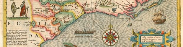
The word “Library” jumped out at me of course. Then the word “Lost.” But lost what? The next word of the title was obscured by the library label. Intrigued, I pulled the oversized book from the new nonfiction shelf of my local library. Immediately I knew I would check it out. The missing word was “Maps.” The Library of Lost Maps by James Cheshire with the enigmatic subtitle An archive of a world in progress. That was full of promise. I’ve always loved old maps. I have a collection of books of old maps, framed prints of old maps, and a few originals. I even chose an image from the 1606 Hondius map of Virginia and Florida for my website logo.
Geography professor James Cheshire’s book is about his discovery of a forgotten archive of old maps in the basement of University College London. Here he describes his first visit as he followed the scent of aging paper swirling around the basement:
I followed this distinctive aroma as it took me to the right of the dingy lecture theatre I’d taught in many times, past the damp of a leaky water fountain and on into an unpromising corridor. On I went until I reached a scruffy turquoise door with the words “Map Room” affixed to it. I pushed at the handle, and, to my amazement, entered an Aladdin’s cave of cartographic treasures.
Inside he found 440 wooden drawers and tens of glass-fronted cabinets holding thousands of maps and hundreds of atlases left virtually untouched since the retirement of curator Anne Oxenham twenty years before. It was once a busy room with university professors and students using the maps for their lectures and assignments. Now digital maps have replaced them and paper map archives the world over have fallen silent.
Most of the maps in the archive are from the nineteenth and twentieth centuries. They record lost worlds, like a map of Hiroshima printed just a few weeks before it was obliterated by the atomic bomb. Or the Soviet Union before its dissolution. The old borders of the Soviet empire are what Putin wishes to restore; copies of Soviet maps were carried by the Russian troops who invaded Ukraine. Cheshire is determined to share the treasures in this room before the collection vanishes like so many others have done, the maps sold to collectors or even discarded. He decides to involve his students in a new class on the history of cartography and data visualization. To his surprise the students are enthralled with the beauty of the maps and the stories they tell. Foreign students are sometimes distressed by borders that don’t match their own understanding of their countries. Others marvel at the prodigious research and adventuring that went into Victorian mapmaking.
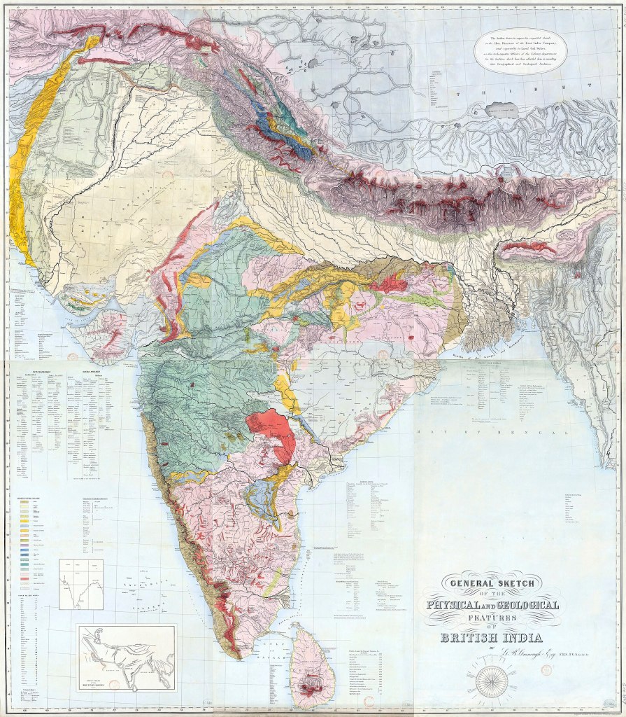
One of the rarest maps in the collection is this 1855 map of the physical and geological features of British India created by George Bellas Greenough. Cheshire explains that he was one of the first to see the potential for maps to be more than just showing people where to go. He saw them as an essential means to convey all kinds of information important for science, industry, and government. It took him over a decade to compile all the information for this map and then the engravers worked on it for over a year. Detailing all the mineral wealth of India the map served as a tool for Empire and the East India Company.
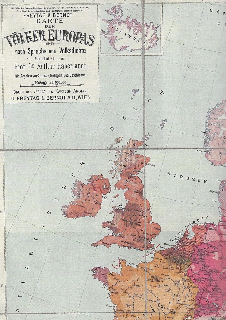
Browsing the pages of this book we see maps of war, maps attempting to establish peace by creating borders on cultural lines, specialized maps like the glaciers of the Himalayas and the seal colonies of the Antarctic, highly controversial maps of the Middle East, and maps designed specifically to manipulate public opinion. One of these was by the German professor Arthur Haberlandt. After the defeat of Germany in the First World War the convention of German geographers passed a resolution:
It is a national necessity and duty that the link to Germandom of the areas which were torn from the German Empire in the Treaty of Versailles remain clearly visible in atlases, and advocates that only those works for which this is the case, be used for instruction in all school grades.
Haberlandt’s map fit that directive precisely. By the time Hitler came to power students had been taught which lands were “really” theirs for twelve years, building up the grievances of the German people. Among the many World War II maps, Cheshire was able to spread out German maps of bombing targets in Britain alongside British maps of bomb damage and of post-war reconstruction.
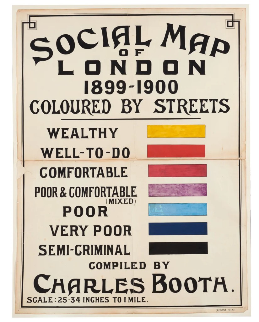
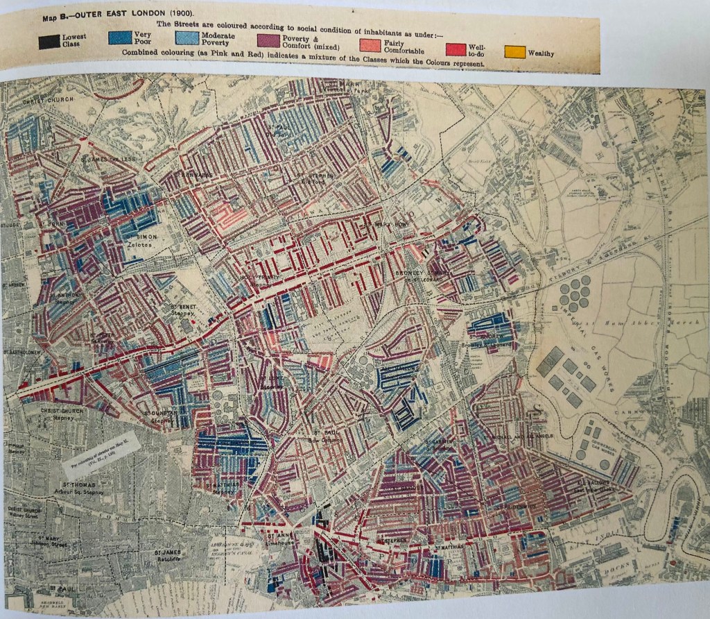
The book is full of stories of individual map makers, often eccentric and obsessive characters. My favorite maps in the book were made by Charles Booth, a wealthy Victorian businessman who was concerned with the plight of the poor in London. He teamed up with social reformer Beatrice Webb to conduct a survey on Life and Labour of the people in London published between 1889 and 1903. In addition to the text Booth created maps of London districts with each street color coded for social class and financial condition. The information was gathered by a team of researchers interviewing School Board Visitors, clergy, and police. Though well meaning the survey drips with judgmental condescension towards the poor. The lowest class was defined as “vicious, semi-criminal.” Beatrice Webb described the expressions on dockworkers’ faces as either “bestial content or hopeless discontent.”
James Cheshire was right. He did indeed walk into an Aladdin’s cave of treasures. In this book he shares the magic and beauty of maps, bringing lost worlds like the Victorian streets of London back to life.
